why I switched from satellite mode to terrain mode
Posted on November 25, 2023
Ok, so the title of this blog post is clickbait, I admit. Say something controversial to get people onto your page.
Really, there’s not one “strictly better” mode between satellite and terrain. They both have their places, they both have their applications (which is what this blog post is about). One thing I can deterministically say: there is absolutely no reason to use the “default” roadmap. It’s literally just terrain mode with less information.
With that out of the way, I’ll next tell the story of why I came around on terrain mode – and why I now use it as much as – or more than – satellite mode.
I’ve lived in a state of satellite mode supremacy for as long as I can remember. It’s always been my default mode (as you can tell implicitly from the first stanza of my poem about google maps). In satellite mode, you can zoom in and look at the roof of your house, then zoom back out and look at the roof of someone else’s house halfway across the planet in some barren desert. And I think that’s dope.
Satellite mode is also great for scoping out #vanlife spots. You can see breaks in the forest, tire tracks, and sometimes even parked campers. Overlay this spy-satellite-esque intel with land ownership data and you can find a slew of spots without getting up off your couch.
For instance, see the image below of Riffe Lake (which I wrote about here). From this satellite image, you can see a bunch of obvious camping spots, established roads, and parked vehicles. The red one sort of looks like a vanlifer van.

The same view on terrain mode? Not quite as information dense.

Satellite mode is unrivaled – or so I thought. Up until a month ago, I spent probably 95% of my google maps time in satellite mode. Since then, I’ve been dedicating a lot more of that time to terrain mode.
Why did I make the switch? Because there are specific places in which terrain mode is actually more informative than satellite mode – namely, the mountains.
After Riffe Lake, we headed south from Randle into the Gifford Pinochet National Forest. There’s not much cell service nestled between Mt. St. Helens and Mt. Adams, so I did what I would normally do before going off grid: take some screenshots. I scoped out the places we thought we’d go using satellite mode so we could find these spots without service. Par for the course.
I also took some zoomed-out shots of the entire forest to serve as “shit just hit the fan and we have to hike out of here” maps. But I switched to terrain mode and quickly realized which map I’d actually want in this situation.


You can sort of see the definition of the steepest slopes in satellite mode, but it’s nowhere near the type of definition you get in terrain mode. Look down to the northwest of Trout Lake – it’s nearly impossible to see those valleys on satellite mode, but they’re immediately apparent on terrain mode.
Writing this all out, it makes sense in a “no shit” kind of way – it’s terrain mode, it shows the terrain. But after being a stalwart user of satellite mode for most practical applications, my sudden shift to terrain mode would’ve shocked me from a year or two ago.
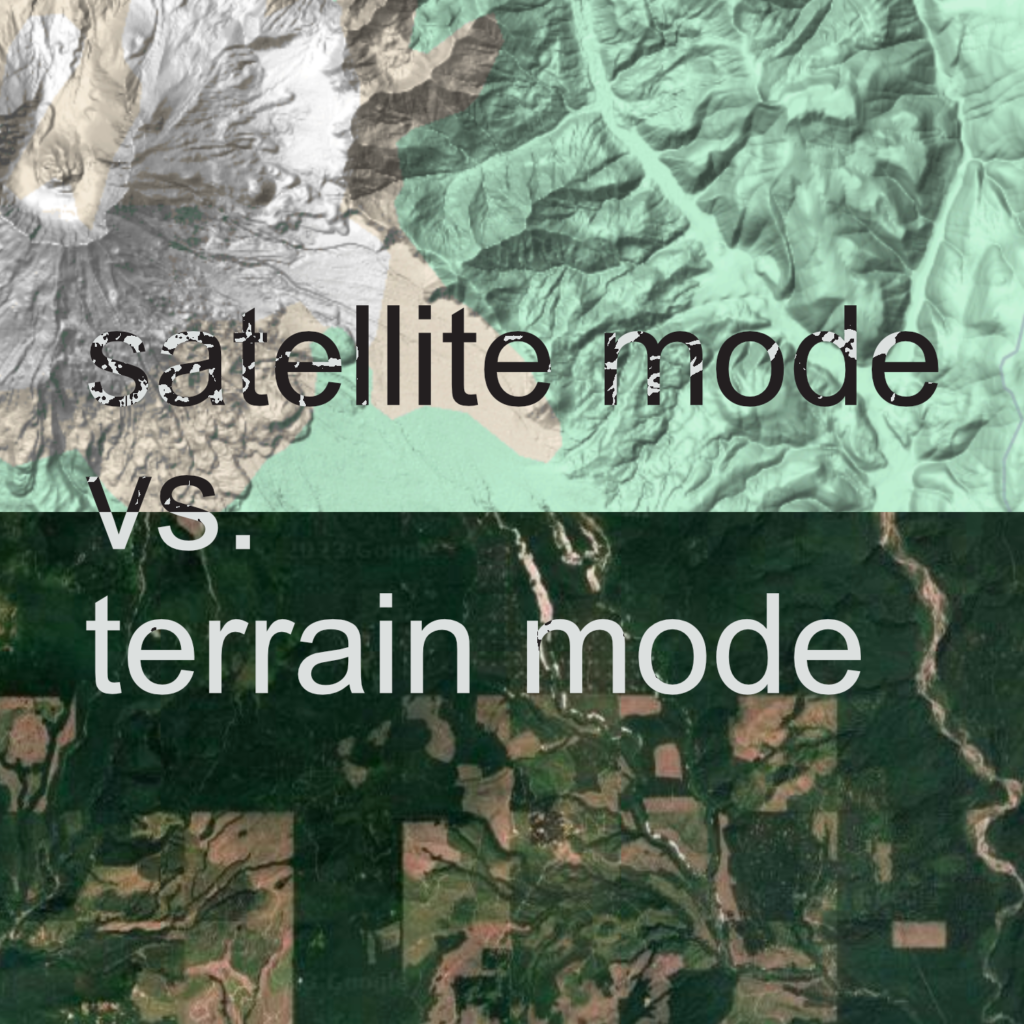
Now that I’ve been living in this mountainous region for a while – and leaning into my newfound terrain mode abilities – I’ve noticed the patterns you can see in satellite mode hint at the terrain. For example, see this sample of land from the hills out east of the Portland metro. This is (almost) the exact same view in satellite and terrain mode:


The general idea: flat areas get clearcut and farmed for livestock or cash crops (the beige squares on the land-use checkerboard) ; flat-ish areas are timber lands that get periodically clearcut and replanted (light green squares) ; and incredibly steep areas – or areas protected by incredibly steep slopes – are timber lands that can’t get easily clearcut (dark green squares).
Once you learn this pattern, you can begin to “see” the slopes on satellite mode – but not half as easily and not half as definitively as on terrain mode. And from this “achilles heel” of satellite mode sprung my recent obsession with terrain mode.
If I go back somewhere flatter, I’ll probably go back to using satellite mode 95% of the time. Until then, I’ll be splitting my time between the modes much more evenly than I was before.